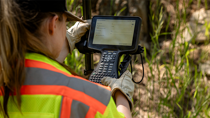
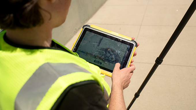
Capture Field Data with Confidence
Equip your teams with powerful mobile solutions that simplify data collection, ensure precision in the field, and seamlessly integrate with your survey or GIS workflows.
Accurate Data Collection. Anywhere You Work.
Our solutions simplify workflows, ensuring that you capture precise spatial data in the field, making it easier to analyze, visualize, and make informed decisions. Whether you're working with environmental data, utilities, or infrastructure, our tools empower you to collect and manage data with confidence.
Trimble Field Data Solutions from Cansel
Trimble field solutions from Cansel connect your team from the field to the office, streamlining data collection and project workflows.
Key Benefits of Trimble solutions:
- Enables high-precision positioning using GNSS receivers, total stations, scanners, and more.
- Minimizes human error through automated data capture and validation.
- Enhances the accuracy of staking, layout, and as-built verification.
- Provides intuitive interfaces tailored for field crews.
- Supports export to various formats (CAD, GIS, BIM, etc.) for seamless integration to various office platforms like Trimble Business Center, CAD-based and Esri environments.
- Syncs field and office data in real time via cloud connectivity (e.g., Trimble Connect).
- Improves project visibility for managers and supervisors.
- Adaptable for construction, surveying, utilities, mapping, and geospatial professionals.
Field technology just got an upgrade.
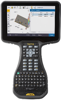
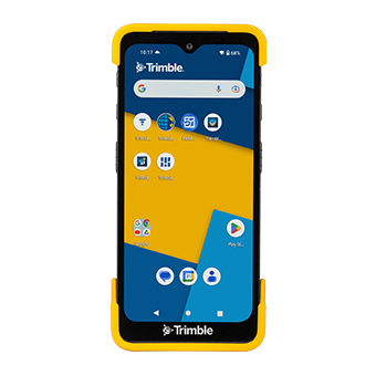
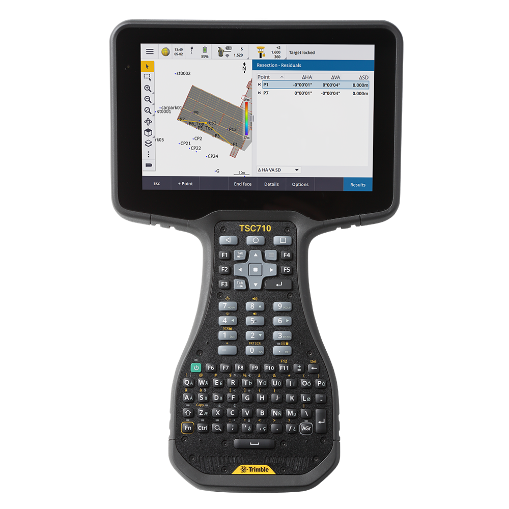
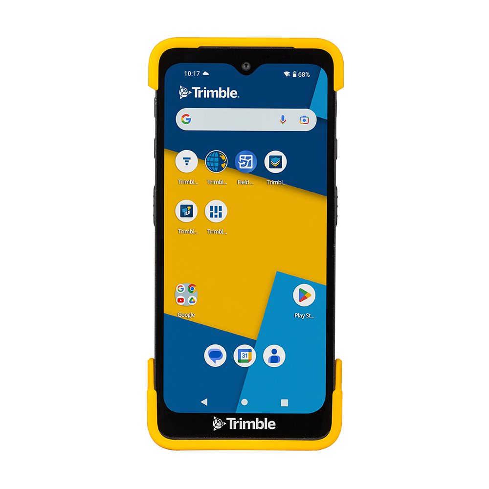
Trimble TSC710
Powered by the latest Android operating system and robust processing and communication capabilities.
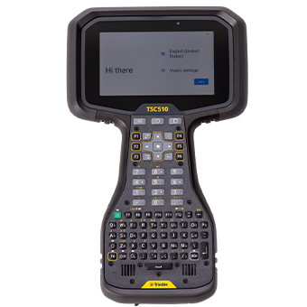
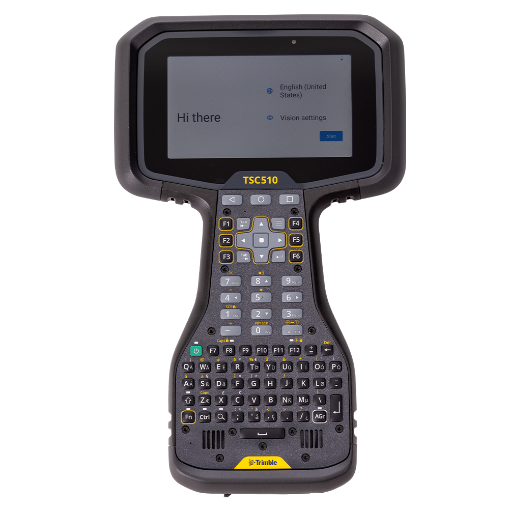
Trimble TSC510
Enhanced power, connectivity, and durability in challenging environments.
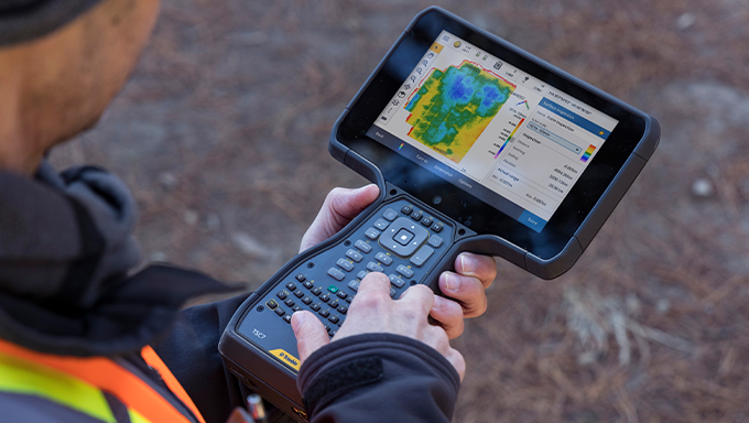
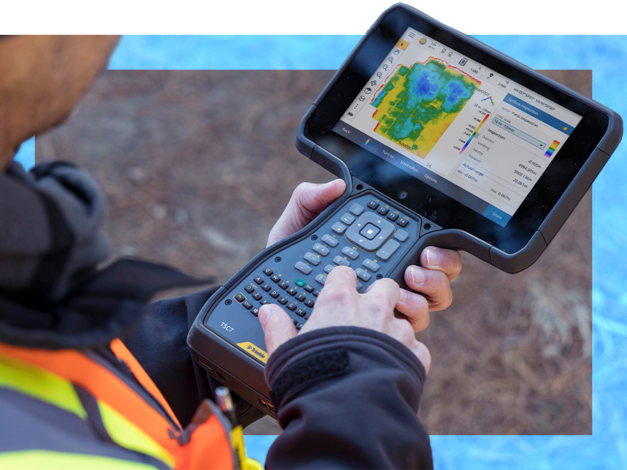
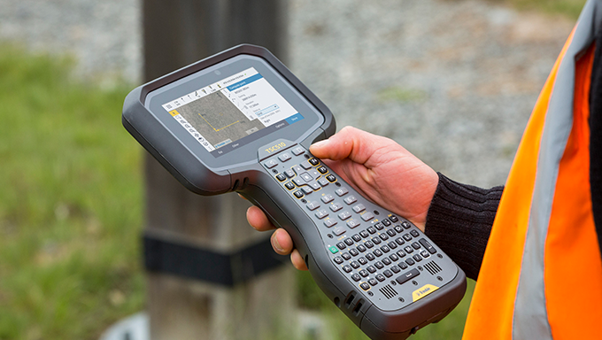
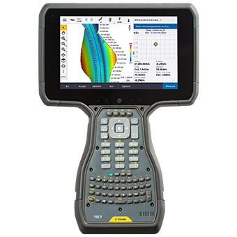
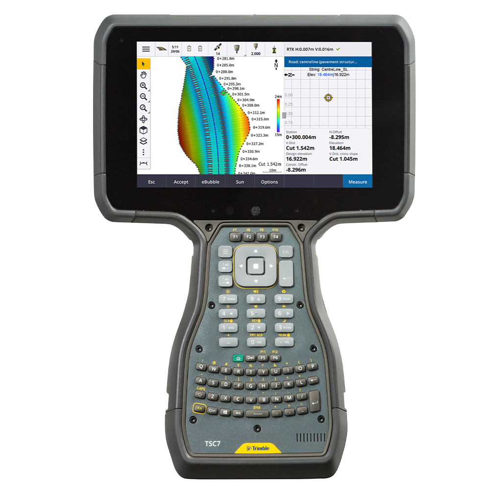
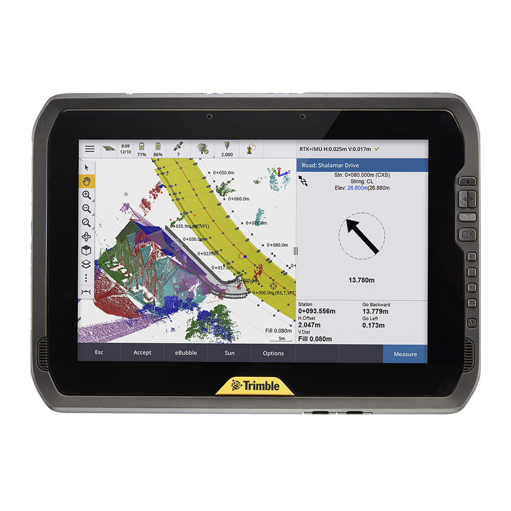
Trimble TSC7
Rugged survey controller that gets the job done.
Trimble TDC6
Professional, high-performance data capture.
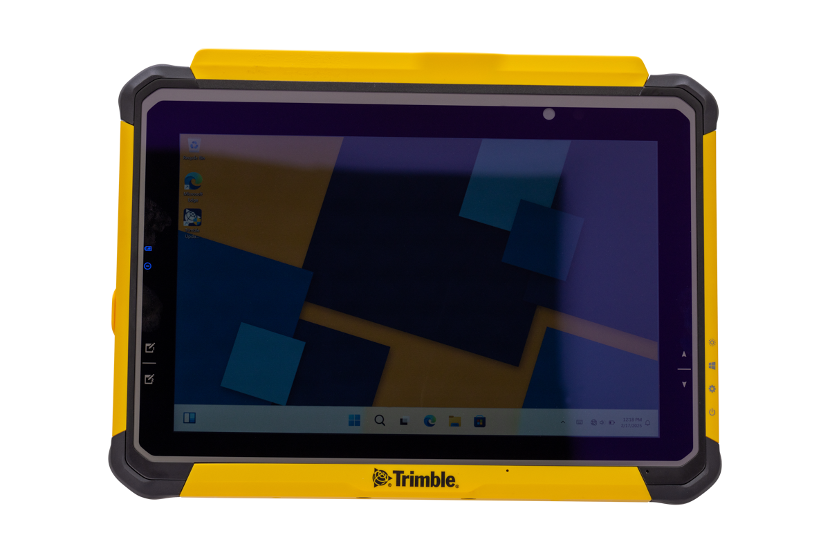
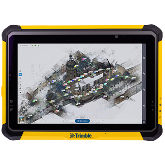
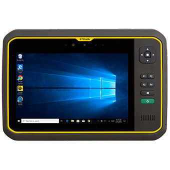
Trimble T110
Powerful tablet with all-day battery life and seamless integration into the Trimble software ecosystem.
Data Collectors
|
|
 |
 |
|
 |
 | |
| TSC710
New! Powered by the latest Android operating system, with more memory, faster performance, and robust processing and communication capabilities.
| TSC510
New! Enhanced power, connectivity, and durability in challenging environments.
| TSC7
Rugged survey controller that gets the job done. | TDC6
Professional, high-performance data capture. | T110
New! Powerful tablet with all-day battery life and seamless integration into the Trimble software ecosystem.
| T10x
Rugged tablet to process intensive projects. | T7
Purpose built for demanding survey and GIS applications. | |
| Operating System | Android 14 | Android 14 | Windows 10 | Android 12 | Windows 11 | Windows 11 | Windows 10 |
| Screen size | 17.8 cm/7” | 12.7 cm/5.0” | 17.8 cm/7" | 16 cm/6.3" | 25.6 cm/10.1" | 256 mm/10.1" | 17.8 cm/7" |
| Screen type | Multi-touch | Multi-touch | Multi-touch | Multi-touch | Multi-touch | Multi-touch | Multi-touch |
| Memory | 8 GB | 8 GB | 8 GB | 6 GB | 32 GB | 32 GB | 8 GB |
| Data storage | 128 GB | 128 GB | 64 GB | 64 GB | 1 TB | 1 TB | 128 GB |
| Battery Life | 10 h | 16 - 18 h | 4 – 7 h | 9 h | All-day battery life with smart power management system | Vary based on screen brightness, applications, power management, etc. | 8 h |
| Internet connection | Wi-Fi, 5G, worldwide LTE 4G & UMTS 3G available | Bluetooth, Wi-Fi, 5G | Bluetooth, Wi-Fi, 4G | Bluetooth, Wi-Fi, 5G | Wi-Fi, 4G LTE worldwide coverage | Bluetooth, Wi-Fi | 4G LTE |
| Camera | Rear camera: 16 MP | Rear camera: 16 MP | Front and Rear | Front and Rear | Rear camera: 8MP | Rear | Front and Rear |
| GNSS accuracy | 2-4 m | - | 2-4 m | 2-4 m | 2-4 m | 2-4 m | 2-4 m |
| Internal GPS with SBAS | GPS yes, not SBAS | Yes | Yes | Yes | Yes | - | Yes |
| Satellites | L1 C/A, GPS/GLONASS/
BeiDou/Galileo/QZSS | Integrated Sierra Wireless EM7590 | Dual Frequency L1 C/A, GPS, GLONASS, BeiDou, Galileo, QZSS | 4M Horizontal RMS in favourable conditions | Integrated u-blox NEO-M8N, L1, GPS / GLONASS / BeiDou | GPS / GLONASS / Galileo / BeiDou / QZSS | Beidou, Galileo, GLONASS, GPS L1 C/A, QZSS | GPS L1 C/A/ GLONASS / Galileo / BeiDou / QZSS | Integrated u-blox NEO-M8N, L1, GPS / GLONASS / BeiDou |
| Field Software | Trimble Access | Trimble Access™ field software or Siteworks software version 1.80 and later; Trimble Connect cloud or WorksManager | Trimble Access (2017 .2x & 2018 and later), Trimble Terraflex | Trimble TerraFlex, Trimble Access, Penmap for Android, ESRI data collection software | Trimble Access, Trimble Perspective, Trimble TerraFlex | Trimble Perspective, Trimble Access | Trimble Access, Trimble TerraFlex |
|
| |
| TSC710
New! More memory and power, plus robust processing and versatile communication capabilities.
| |
| Operating system | Android 14 |
| Screen size | 17.8 cm/7” |
| Screen type | Multi-touch |
| Memory | 8 GB |
| Data storage | 128 GB |
| Battery life | 10 h |
| Internet connection | Wi-Fi, 5G, worldwide LTE 4G & UMTS 3G available |
| Camera | Rear camera: 16 MP |
| GNSS accuracy | 2-4 m |
| Internal GPS with SBAS | GPS yes, not SBAS |
| Satellites | L1 C/A, GPS/GLONASS/ BeiDou/Galileo/QZSS |
| Field Software | Trimble Access |
|
| |
| TSC510
New! Enhanced power, connectivity, and durability in challenging environments.
| |
| Operating system | Android 14 |
| Screen size | 12.7 cm / 5.0" |
| Screen type | Multi-touch |
| Memory | 8 GB |
| Data storage | 128 GB |
| Battery life | 16 - 18 h |
| Internet connection | Bluetooth, Wi-Fi, 5G |
| Camera | Rear camera: 16 MP |
| GNSS accuracy | - |
| Internal GPS with SBAS | Yes |
| Satellites | Integrated Sierra Wireless EM7590 | Dual Frequency L1 C/A, GPS, GLONASS, BeiDou, Galileo, QZSS | 4M Horizontal RMS in favourable conditions |
| Field Software | Trimble Access™ field software or Siteworks software version 1.80 and later; Trimble Connect cloud or WorksManager |
| |
| TSC7
For reliable performance in the field. | |
| Operating system | Android 10 |
| Screen size | 12.7 cm / 5.0" |
| Screen type | Multi-touch |
| Memory | 4 GB |
| Data storage | 4 GB |
| Battery life | 16 - 18 h |
| Internet connection | Bluetooth, Wi-Fi, 5G |
| Camera | Rear |
| GNSS accuracy | 5-10 m |
| Internal GPS with SBAS | Yes |
| Satellites | Integrated Sierra Wireless EM7565; L1 C/A, GPS / GLONASS / BeiDou / Galileo / QZSS |
| Field Software | Trimble Access (2021 or later), ESRI data collection software |
| |
| TDC6
Professional, high-performance data capture. | |
| Operating system | Android 12 |
| Screen size | 16 cm / 6.3" |
| Screen type | Multi-touch |
| Memory | 6 GB |
| Data storage | 64 GB |
| Battery life | 9 h |
| Internet connection | Bluetooth, Wi-Fi, 5G |
| Camera | Front and rear |
| GNSS accuracy | 2-4 m |
| Internal GPS with SBAS | Yes |
| Satellites | GPS / GLONASS / Galileo / BeiDou / QZSS |
| Field Software | Trimble TerraFlex, Trimble Access, Penmap for Android, ESRI data collection software |
| |
| T110
New! Powerful tablet with all-day battery life and seamless integration into the Trimble software ecosystem.
| |
| Operating system | Windows 11 |
| Screen size | 25.6 cm / 10.1" |
| Screen type | Multi-touch |
| Memory | 32 GB |
| Data storage | 1 TB |
| Battery life | All-day battery life with smart power management system |
| Internet connection | Wi-Fi, 4G LTE worldwide coverage |
| Camera | Rear camera: 8 MP |
| GNSS accuracy | 2-4 m |
| Internal GPS with SBAS | Yes |
| Satellites | Beidou, Galileo, GLONASS, GPS L1 C/A, QZSS |
| Field Software | Trimble Access, Trimble Perspective, Trimble TerraFlex |
| |
| T10x
Rugged tablet to process intensive projects. | |
| Operating system | Windows 11 |
| Screen size | 256 mm/10.1" |
| Screen type | Multi-touch |
| Memory | 32 GB |
| Data storage | 1 TB |
| Battery life | Vary based on screen brightness, applications, power management, etc. |
| Internet connection | Bluetooth, Wi-Fi |
| Camera | Rear |
| GNSS accuracy | 2-4 m |
| Internal GPS with SBAS | – |
| Satellites | GPS L1 C/A / GLONASS / Galileo / BeiDou / QZSS |
| Field Software | Trimble Perspective, Trimble Access |
| |
| T7
Purpose built for demanding survey and GIS applications. | |
| Operating system | Windows 10 |
| Screen size | 17.8 cm/7" |
| Screen type | Multi-touch |
| Memory | 8 GB |
| Data storage | 128 GB |
| Battery life | 8 h |
| Internet connection | 4G LTE |
| Camera | Front and rear |
| GNSS accuracy | 2-4 m |
| Internal GPS with SBAS | Yes |
| Satellites | Integrated u-blox NEO-M8N, L1, GPS / GLONASS / BeiDou |
| Field Software | Trimble Access, Trimble TerraFlex |
|
|
 |
 |
| |
| TSC710 | TSC510 | TSC7 | TDC6 | T110 | |
| Operating System | Android 14 | Android 14 | Windows 10 | Android 12 | Windows 11 |
| Screen size | 17.8 cm/7” | 12.7 cm/5.0” | 17.8 cm/7" | 16 cm/6.3" | 25.6 cm/10.1" |
| Screen type | Multi-touch | Multi-touch | Multi-touch | Multi-touch | Multi-touch |
| Memory | 8 GB | 8 GB | 8 GB | 6 GB | 32 GB |
| Data storage | 128 GB UFS Flash Memory | 128 GB UFS Flash Memory | 128 GB | 128 GB | 1 TB |
| Battery Life | 10 h | 16 - 18 h | 4 – 7 h | 9 h | All-day battery life with smart power management system |
| Internet connection | Wi-Fi, 5G, worldwide LTE 4G & UMTS 3G available | Bluetooth, Wi-Fi, 5G | Bluetooth, Wi-Fi, 4G | Bluetooth, Wi-Fi, 5G | Wi-Fi, 4G LTE worldwide coverage |
| Camera | Rear camera: 16 MP | Rear camera: 16 MP | Front and Rear | Front and Rear | Rear camera: 8MP |
| GNSS accuracy | 2-4 m | - | 2-4 m | 2-4 m | 2-4 m |
| Internal GPS with SBAS | GPS yes, not SBAS | Yes | Yes | Yes | Yes |
| Satellites | L1 C/A, GPS/GLONASS/
BeiDou/Galileo/QZSS | Integrated Sierra Wireless EM7590 | Dual Frequency L1 C/A, GPS, GLONASS, BeiDou, Galileo, QZSS | 4M Horizontal RMS in favourable conditions | Integrated u-blox NEO-M8N, L1, GPS / GLONASS / BeiDou | GPS / GLONASS / Galileo / BeiDou / QZSS | Beidou, Galileo, GLONASS, GPS L1 C/A, QZSS |
| Field Software | Trimble Access | Trimble Access™ field software or Siteworks software version 1.80 and later; Trimble Connect cloud or WorksManager | Trimble Access (2017 .2x & 2018 and later), Trimble Terraflex | Trimble TerraFlex, Trimble Access, Penmap for Android, ESRI data collection software | Trimble Access, Trimble Perspective, Trimble TerraFlex |
|
| |
| TSC710 | |
| Operating system | Android 14 |
| Screen size | 17.8 cm/7” |
| Screen type | Multi-touch |
| Memory | 8 GB |
| Data storage | 128 GB UFS Flash Memory |
| Battery life | 10 h |
| Internet connection | Wi-Fi, 5G, worldwide LTE 4G & UMTS 3G available |
| Camera | Rear camera: 16 MP |
| GNSS accuracy | 2-4 m |
| Internal GPS with SBAS | GPS yes, not SBAS |
| Satellites | L1 C/A, GPS/GLONASS/ BeiDou/Galileo/QZSS |
| Field Software | Trimble Access |
|
| |
| TSC510 | |
| Operating system | Android 14 |
| Screen size | 12.7 cm / 5.0" |
| Screen type | Multi-touch |
| Memory | 8 GB |
| Data storage | 128 GB UFS Flash Memory |
| Battery life | 16 - 18 h |
| Internet connection | Bluetooth, Wi-Fi, 5G |
| Camera | Rear camera: 16 MP |
| GNSS accuracy | - |
| Internal GPS with SBAS | Yes |
| Satellites | Integrated Sierra Wireless EM7590 | Dual Frequency L1 C/A, GPS, GLONASS, BeiDou, Galileo, QZSS | 4M Horizontal RMS in favourable conditions |
| Field Software | Trimble Access™ field software or Siteworks software version 1.80 and later; Trimble Connect cloud or WorksManager |
|
| |
| TSC7 | |
| Operating system | Android 10 |
| Screen size | 12.7 cm / 5.0" |
| Screen type | Multi-touch |
| Memory | 4 GB |
| Data storage | 128 GB |
| Battery life | 16 - 18 h |
| Internet connection | Bluetooth, Wi-Fi, 5G |
| Camera | Rear |
| GNSS accuracy | 5-10 m |
| Internal GPS with SBAS | Yes |
| Satellites | Integrated Sierra Wireless EM7565; L1 C/A, GPS / GLONASS / BeiDou / Galileo / QZSS |
| Field Software | Trimble Access (2021 or later), ESRI data collection software |
|
| |
| TDC6 | |
| Operating system | Android 12 |
| Screen size | 16 cm / 6.3" |
| Screen type | Multi-touch |
| Memory | 6 GB |
| Data storage | 128 GB |
| Battery life | 9 h |
| Internet connection | Bluetooth, Wi-Fi, 5G |
| Camera | Front and rear |
| GNSS accuracy | 2-4 m |
| Internal GPS with SBAS | Yes |
| Satellites | GPS / GLONASS / Galileo / BeiDou / QZSS |
| Field Software | Trimble TerraFlex, Trimble Access, Penmap for Android, ESRI data collection software |
|
| |
| T110 | |
| Operating system | Windows 11 |
| Screen size | 25.6 cm / 10.1" |
| Screen type | Multi-touch |
| Memory | 32 GB |
| Data storage | 1 TB |
| Battery life | All-day battery life with smart power management system |
| Internet connection | Wi-Fi, 4G LTE worldwide coverage |
| Camera | Rear camera: 8 MP |
| GNSS accuracy | 2-4 m |
| Internal GPS with SBAS | Yes |
| Satellites | Beidou, Galileo, GLONASS, GPS L1 C/A, QZSS |
| Field Software | Trimble Access, Trimble Perspective, Trimble TerraFlex |
Smart Field Software to Power Your Productivity
At Cansel, we support your entire workflow from field to finish. Our field software solutions are designed to boost efficiency, improve accuracy, and integrate seamlessly with the tools you rely on. Backed by Trimble technology and supported by Cansel’s nationwide team, our software solutions help you confidently capture, visualize, and manage data, whether you’re surveying, mapping, or managing infrastructure projects.
Featured Field Software
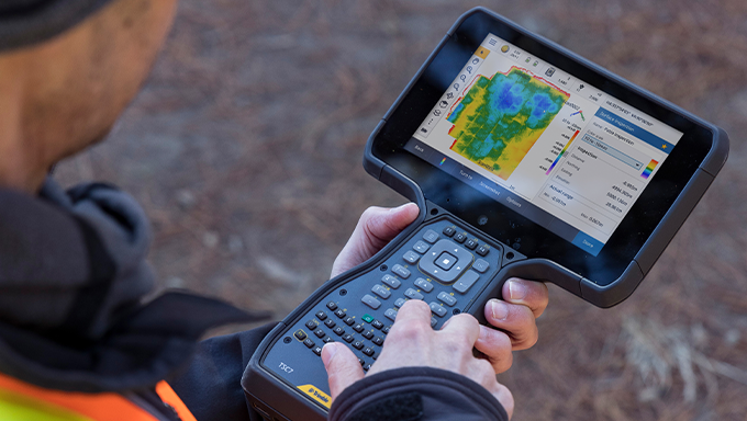
Trimble® Access™
Smart Field Software Built for Surveying
Purpose-built field apps with intuitive workflows and industry tools for faster, more accurate fieldwork across roads, rail, tunnels, and pipelines.
Key Applications:
- Roads: Simplified roading workflows with visual design and alignment tools.
- Monitoring: Control & deformation surveys made easy with repeatable, structured workflows.
- Pipelines: Capture pipe attributes and verify joint data, every step of the way.
- Tunnels: Survey and stakeout with precision, ideal for complex tunnel environments.
- Mines: Optimize field efficiency for mining layouts and machinery positioning.
- Rail: Designed for rail-specific workflows, from stakeout to as-built verification.
- SDK: Customize your workflows by developing field-ready applications using the Trimble Access Software Development Kit.
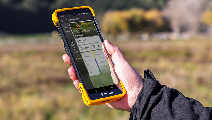
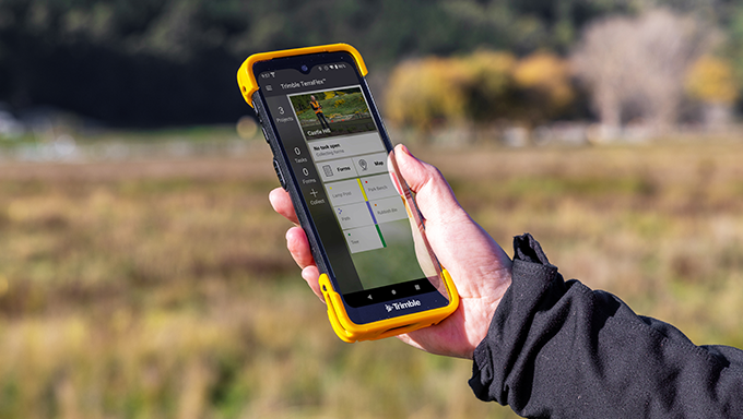
Trimble TerraFlex®
Smart, Simple Field Data Collection for GIS and Mapping
Fast, flexible, high-accuracy data capture with custom forms and GNSS precision. Reliable data collection anytime, anywhere.
Key Features:
- Custom Forms: Build intuitive forms tailored to your data needs.
- Cloud Sync: Seamless flow of data between field and office.
- Offline GNSS Corrections: Capture high-accuracy data even without live correction services.
- Remote Capture: Use laser offsets to gather hard-to-reach data.
- Update Existing Data: Edit or maintain records with ease.
- Collaboration Ready: Share data and reports quickly across teams.
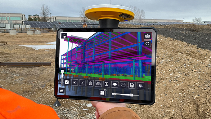
Trimble SiteVision®
Augmented Reality for Real-World Insight
High-accuracy augmented reality (AR) for planning, design verification, and stakeholder engagement. Detect conflicts and visualize outcomes before breaking ground.
Key Features:
- Precision Mapping: Centimeter-accuracy with Trimble Catalyst.
- Device Compatibility: Runs on Android and iOS devices.
- Versatile Design: Lightweight, pole or handheld options.
- Live Visualization: Real-time visualization in plan or cross-section views.
- Cloud-Connectivity: Via Trimble Connect.
- Broad Compatibility: Trimble and open industry file types.
Flexible Subscription Plans
Scale with confidence. Choose the plan that fits your workflow.
Cansel offers flexible subscription options for Trimble® Access™, Trimble TerraFlex®, and Trimble SiteVision® software, giving you the freedom to start small or scale up based on your project needs. Whether you're managing a small team or a full-scale field operation, our plans provide access to the latest tools, updates, and support.
Why Choose a Subscription?
- Access the latest software updates and features.
- Lower upfront costs compared to perpetual licenses.
- Scalable for seasonal or project-based work.
- Includes support and cloud connectivity (where applicable).
Available options:
Trimble Access
GNSS and General Survey options to match your field workflow.
GNSS and Survey options built for your field needs
Trimble TerraFlex
Monthly or annual plans for efficient mobile GIS data collection.
Monthly or annual plans for mobile GIS data collection
Trimble SiteVision
Flexible terms to support on-site visualization and AR integration.
Flexible plans for on-site visualization and AR
Trimble Mapping & GIS Solutions Product Configuration Guide
Choose the product, operating system or device you're using.