Earth Observation
Unlocking reliable information for better decision-making
Now There’s a Smarter, Faster, Easier Way to Order Satellite Imagery!
Introducing Cansel’s Satellite Imagery Online Ordering Platform—your streamlined solution for finding and requesting Earth observation data in just a few clicks.

Introducing
Can-XTerra™ Satellite Imagery Online Ordering Platform
Search for archive imagery or request new acquisitions, and we’ll take care of the rest.
Introducing
Satellite Imagery Online Ordering Platform
Search. Validate. Request.
Tired of back-and-forth emails and manual processes? Cansel brings you a modern platform designed to simplify how you search and request satellite imagery.
Whether you need high-resolution data for a single site or multiple areas, it puts you in control - with faster access, smarter previews, and a smoother experience from start to finish.
You may now process requests more efficiently, improving communication and speeding up delivery.
Just type a location, click points on the map, or upload a reference file to define your area of interest. Can-XTerra™ will allow you to visualize available imagery, that you can then validate, and order with confidence. Can-XTerra™ also allow you to request the acquisition of new satellite imagery, using the Tasking tab.
Key Features:
- Fast-Loading Image Previews
View available imagery in seconds—faster than any platform we’ve tested. Quickly confirm image quality before ordering. - Multi-AOI Search
Search multiple areas of interest (AOIs) in one session—no need to start over for each location. - Search for archived imagery or request the acquisition of new images
Can’t find what you need in our archives? Send us a tasking request and we’ll acquire new imagery for you - Shareable Links
Share your search session with teammates to align and approve before placing an order. Streamline internal collaboration. - Smart Filtering and Sorting
Filter by date, resolution, cloud cover, and more to zero in on exactly what you need—fast.
See how easy it is to use!
Play video to learn: How to enter critical variables for your imagery tasking request, such as resolution and acceptable cloud coverage, so the system can recommend the most suitable satellite for your project. With tailored options for beginners and advanced users.Play video to learn: How to query our archive using spatial coordinates, polygon drawing tools, or KML/GeoJSON imports. This guide covers image previewing and the process for submitting search exports directly for order fulfillment.Prefer to read the User Guide?
View the PDF and follow step-by-step instructions at your own pace.
Open the full tutorial →Discover Can-XTerra™, Cansel’s Satellite Imagery Ordering Platform!
More control. Less guesswork. Faster turnaround.
Start exploring today and experience how easy it is to order the imagery you need—without wasting time.
Discover Cansel’s Satellite Imagery Ordering Platform!
More control. Less guesswork. Faster turnaround.
Earth Observation provides critical information for key decisions across a range of industries.
Earth Observation (EO) uses satellites, aircraft, and drones to collect data on the Earth's physical, chemical, and biological systems. This includes imagery and measurements of temperature, precipitation, vegetation, land use, and more. EO supports better decision-making and helps businesses improve efficiency, lower costs, and unlock new opportunities for innovation and growth.
©Airbus DS 2022

Energy & Utilities
EO can provide valuable insights for the energy sector, such as monitoring the condition of infrastructures, like power lines and transmission grids, as well as vegetation growth and risks. This can help utilities optimize distribution and vegetation management activities, reduce costs, and improve reliability.
©Powered by Planet
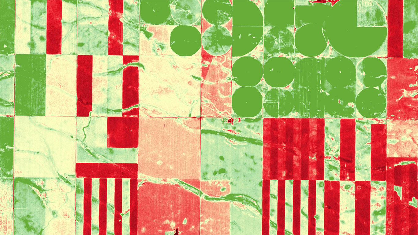
Agriculture
In agriculture, EO can help farmers monitor crop growth, identify areas of stress, and optimize irrigation and fertilizer use. This can lead to increased crop yields and reduced costs, protect the environment, and ultimately drive profitability.
©CNES 2023, Distribution Airbus DS
Infrastructure & Transportation
EO enables infrastructure companies to monitor and assess the condition and performance of their assets, such as railways and airports. This can be used to identify potential issues or failures and provide an opportunity to take preventive measures. Decision makers in these industries can optimize the location and design of their projects, minimizing environmental impact and maximizing efficiency.
©ASAL, Distribution Airbus Defence
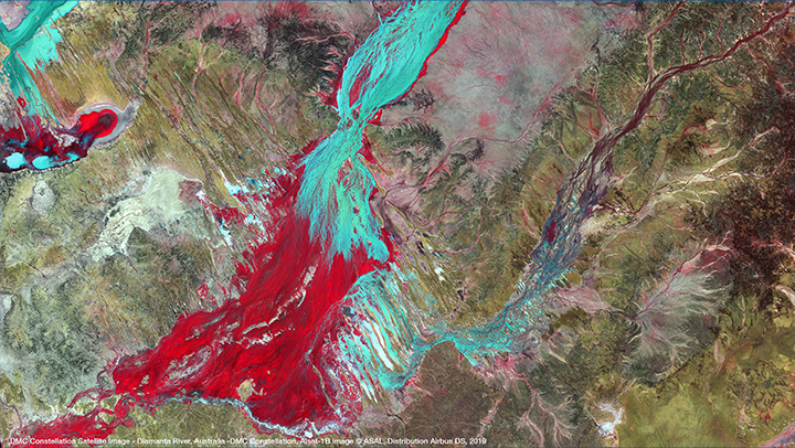
Risk Management & Public Safety
EO is also used in risk management to develop emergency response plans and protect public safety. Resources can therefore be managed more efficiently. For example, satellite imagery can be used to monitor water levels in rivers and floods, monitor wildfires and assess the damage, and optimize energy use in buildings.
©Airbus DS 2022
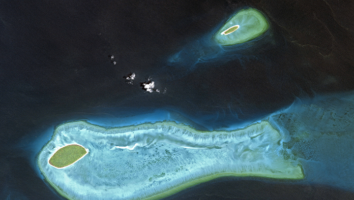
Product Development, Environmental Insights & Scientific Research
By leveraging satellite or aerial imagery and other types of data, companies can develop new products and services, such as precision agriculture tools, smart city solutions, and environmental monitoring systems. These insights can also be used to support scientific research and discovery in areas like climate change, oceanography, and biodiversity conservation.
Applications
Earth Observation supports a broad range of applications that help organizations clearly understand on-the-ground conditions and make smarter, more efficient decisions.
- Utility vegetation and asset mapping and management
- Forest inventory and monitoring
- Urban planning
- Natural resource identification, mapping and assessment
- Environmental and sensitive ecosystem mapping and monitoring
- Crop identification and mapping and health monitoring
- Hydrologic mapping and network correction
- Flight simulation
- Agriculture and agricultural insurance
Products
Our products include high-quality maps, imagery, and remote-sensing data from reputable satellites, providing accurate and reliable information for any targeted area of interest.
- Satellite imagery and derived products
- Up to 30 cm multispectral satellite imagery
- SAR, hyperspectral, and nighttime imagery and satellite video also available
- Digital terrain models and topographic maps
- Orthoimagery and seamless orthomosaics
- Customs maps and projects
- And much more!
Services
We complement imagery delivery with GIS data modeling, monitoring, and change detection, supported by a dedicated team that provides expert guidance and additional specialized services.
- Utility vegetation management
- Monitoring and change detection
- 3D modeling
- Emergency image acquisition (e.g., flood or fire)
- GIS data modeling
- Imagery order desk and expert advice
Earth Observation (EO) is the process of gathering information about the Earth’s physical, chemical and biological systems using remote sensing technologies, such as satellites, airplanes, and drones. The data collected includes images and measurements of various environmental parameters such as temperature, precipitation, vegetation, land use and land cover, among others.
One of the key benefits is that it can provide critical information for decision-making in a range of industries. For instance:
- EO can provide valuable insights for the energy sector, such as monitoring the condition of infrastructures, like power lines and transmission grids, as well as vegetation growth and risks. This can help utilities optimize distribution and vegetation management activities, reduce costs, and improve reliability.
- In agriculture, EO can help farmers monitor crop growth, identify areas of stress, and optimize irrigation and fertilizer use. This can lead to increased crop yields and reduced costs, protect the environment, and ultimately drive profitability.
- EO enables infrastructure companies to monitor and assess the condition and performance of their assets, such as railways and airports. This can be used to identify potential issues or failures and provide an opportunity to take preventive measures. Decision makers in these industries can optimize the location and design of their projects, minimizing environmental impact and maximizing efficiency.
- EO is also used in risk management to develop emergency response plans and protect public safety. Resources can therefore be managed more efficiently. For example, satellite imagery can be used to monitor water levels in rivers and floods, monitor wildfires and assess the damage, and optimize energy use in buildings.
- By leveraging satellite or aerial imagery and other types of data, companies can develop new products and services, such as precision agriculture tools, smart city solutions, and environmental monitoring systems. These insights can also be used to support scientific research and discovery in areas like climate change, oceanography, and biodiversity conservation.
Earth Observation provides valuable information for decision-making and drives business by improving efficiency, reducing costs, and creating new opportunities for innovation and growth.
Applications
- Utility vegetation and asset mapping and management
- Forest inventory and monitoring
- Urban planning
- Natural resource identification, mapping and assessment
- Environmental and sensitive ecosystem mapping and monitoring
- Crop identification and mapping and health monitoring
- Hydrologic mapping and network correction
- Flight simulation
- Agriculture and agricultural insurance
Products
- Satellite imagery and derived products
- Up to 30 cm multispectral satellite imagery
- SAR, hyperspectral, and nighttime imagery and satellite video also available
- Digital terrain models and topographic maps
- Orthoimagery and seamless orthomosaics
- Customs maps and projects
- And much more!
Services
- Utility vegetation management
- Monitoring and change detection
- 3D modeling
- Emergency image acquisition (e.g., flood or fire)
- GIS data modeling
- Imagery order desk and expert advice
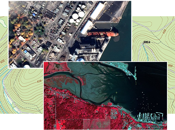
Satellite Images Samples
Below are several image satellites samples available for download. Most of the files are very large. Please check the file size before starting the download.


Toronto, Ontario, Canada
©Astrium
Sensor: TerraSAR-X
Resolution: 1 m
(16 MB)


St-Benoît-du-Lac, Quebec, Canada
©Airbus
Sensor: SPOT 6
Resolution: 1.5 m
(50 MB)

Torngat Mountains National Park, Canada
©Airbus
Sensor: SPOT 5
Resolution: 5 m
(24 MB)