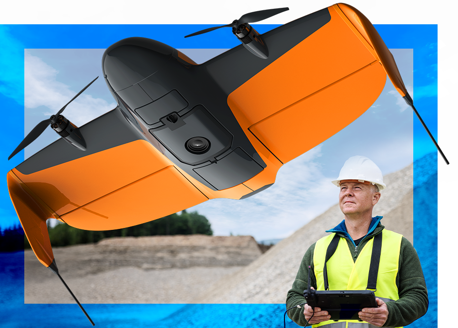
Survey-grade accuracy.
No GCPs. No site shutdowns.
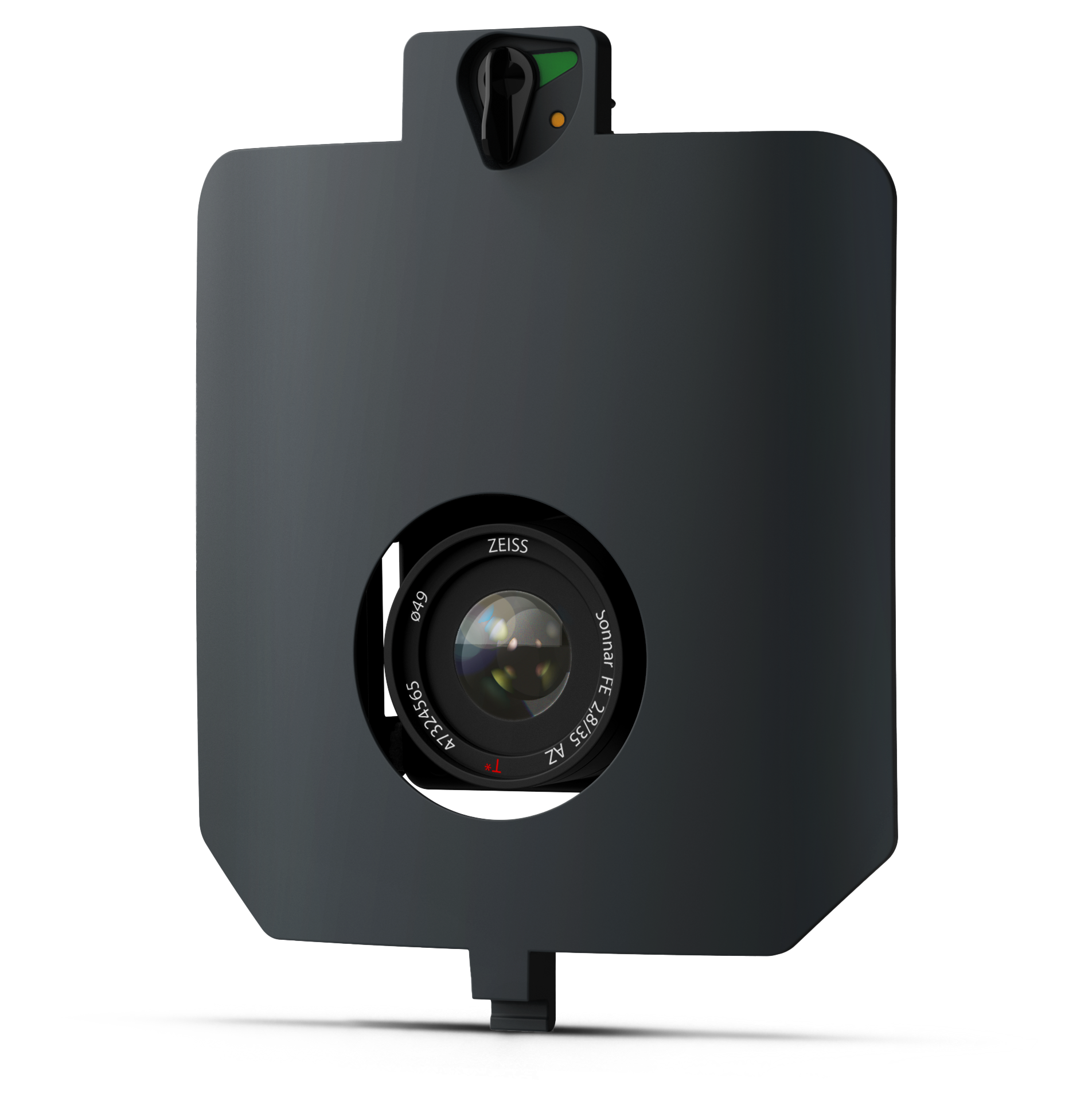
Our highest-accuracy sensor for repeatable surveys on active sites.
- Coverage: 670 ac/270 ha in one flight
- Absolute Accuracy: 0.1 ft/3 cm with PPK
- Lowest GSD: 0.2 in/ 0.5 cm px
Survey 6x Faster & Save 60% on Labour
Traditional photogrammetry relies on ground control points (GCPs) to correct errors from camera geometry, image timing, and positioning uncertainty. SURVEY61 removes the most time-consuming part of the field work, so you no longer need to spend hours placing and measuring dozens of targets across the site.
SURVEY61 reduces several of these dominant error sources directly during capture through:
- 61MP sensor
- Low-distortion optics
- Mechanical shutter
- Precise PPK position
The result:
- Skip the GCPs: Rely on precise image geotagging and high-accuracy PPK positioning.
- 6x Faster Field Work*: Shorter flight times + zero time spent on ground target placement.
- Safety First: Keep your teams away from hazards on active sites and heavy equipment.
*6x less time spent in the field compared to traditional multicopter workflows, achieved through shorter flight and reduction of time spent on Ground Target placement.
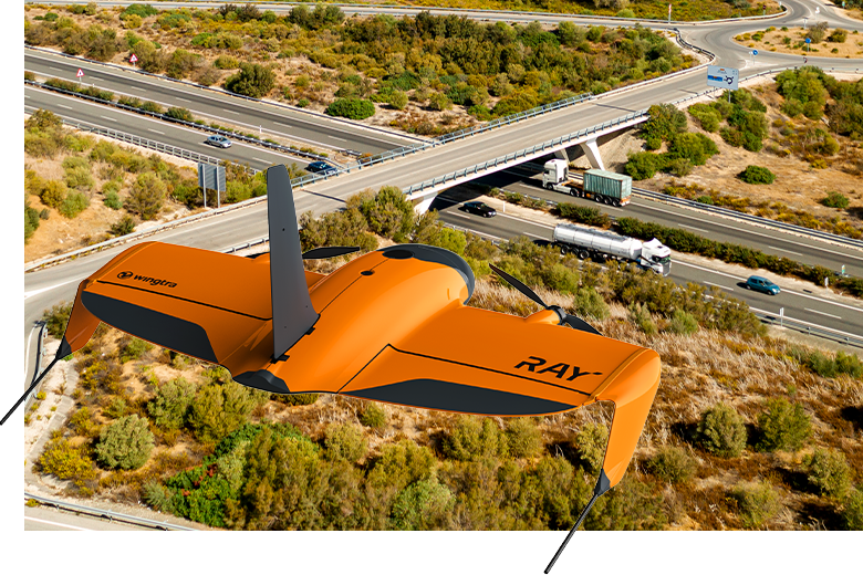
Capture Active Sites Without Waivers
Survey where the work happens. Fly with peace of mind.
- Designed for Compliant Operations: Legally fly over roads, infrastructure, and populated areas.
- Take on More Jobs: Clear the hurdles for the vast majority of survey projects without waiting or administrative complexity.
- No Shutdowns: Keep your crews working while you capture data from above using the integrated parachute system.
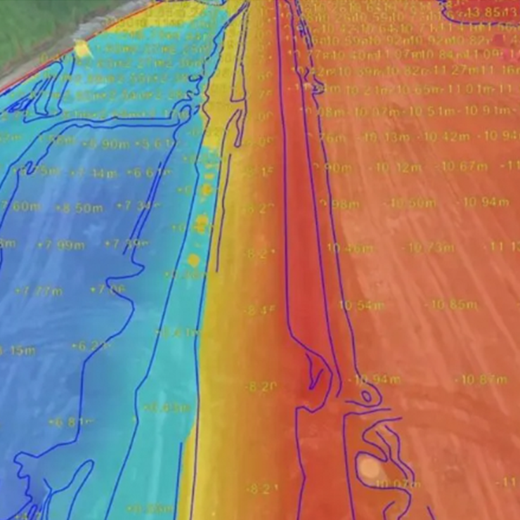
High-Frequency, Repeatable Data for High-Stakes Projects
Deliver survey-grade precision across every phase of your operation.
Construction & Earthworks
Control your margins with repeatable, next-day site insights.
- Track Progress: Accurate topographic surveys and cut-and-fill tracking.
- Verify Grading: Ensure site planning aligns with reality to avoid rework.
- Reconcile Volumetrics: Reduce cost variance by up to 70% with verifiable data.
- Zero Downtime: Fly over active highways and sites with an OOP approved system—no waivers or shutdowns required.
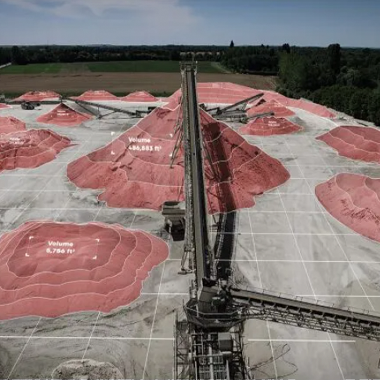
Mining & Metal
Maximize inventory accuracy without exposing crews to site hazards.
- Stockpile Inventory: High-accuracy volumetrics for precise billing and compliance.
- Change Detection: Map pits and mines at short intervals to monitor extraction rates.
- Enhanced Safety: Survey active equipment and high-traffic zones using OOP-approved flight.
- Massive Coverage: Map 400 acres per field hour to get a total site view by morning.
From Flight to Finish: Data by Tomorrow Morning
A streamlined, single-toolchain workflow that eliminates the "data bottleneck."
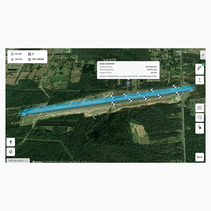
Plan & Prep In Minutes
Build flight plans in WingtraCLOUD and share them with a simple link.
- No Version Confusion: Everyone works off the same live plan—no email chains.
- Deploy Faster: Plan and execute across more sites with fewer restrictions.
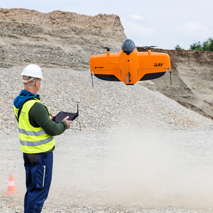
Capture 400 Acres per Hour
Maximize your field productivity with a high-efficiency VTOL workflow.
- Rapid Setup: 5-minute deployment with zero GCPs required.
- Massive Output: Map 400 acres or 4 linear miles in under an hour (including setup/pack-up).
- Extreme Endurance: Up to 770 acres in a single flight.
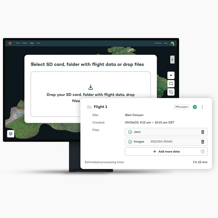
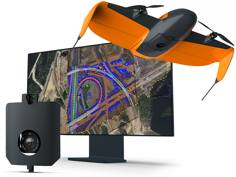
Process in a Few Clicks
Upload data to WingtraCLOUD and let the system handle the heavy lifting.
- Total Automation: Geotagging and processing in one seamless workflow.
- Fast Turnaround: Under 5 hours of processing per 100 acres.
- Next-Day Insights: Ready for delivery by the following morning.
Analyze & Share (Instantly)
Visualize and collaborate directly in your browser—no downloads needed.
- Instant Collaboration: Share a live map link with clients or teams.
- Site Reality vs. Design: Overlay CAD data to verify grading and alignment.
- Built-in Tools: Measure points, lines, and areas directly on the map.
SURVEY61 tech specs
| Sensor type | RGB nadir |
| Megapixels | 61 MP |
| Maximum coverage in one flight
at 120 m (400 ft) flight altitude | 270 ha (670 ac)
at 1.3 cm/px (0.51/px) GSD |
| Maximum field productivity
Including set up time, with 3 check points, preflight checks, flight with 1 mile VLOS. SURVEY61 @ 0.5 in/px (400 ft), 70% side, 70% front, 22 m/s flight speed | 400 ac (160 ha) or 4 linear miles (6 km)
|
| Maximum flight time | 59 min |
| Absolute accuracy (RMS x, y, z)
with PPK | 3 cm (0.1 ft) |
| Best Ground Sample Distance (GSD / resolution)
at 46 m AGL (150 ft) | 0.5 cm/px (0.2 in/px) |
Talk to a Sales Expert Today
Still have questions?