The Ultimate Utility Mapping & Locating Bundle
Survey-grade accuracy. Seamless workflows. Nationwide coverage.
Everything you need to locate, map, and deliver high-precision utility data in a single pass—now with savings of $3,000!
What's included:
- Radiodetection RD8200SG Survey Grade Locator Kit: Includes the high-output TX-10B transmitter and all essential field accessories.
- TerraFlow Utility Mapper Software: 1-year subscription for streamlined digital data capture.
- Can-Net RTK: 1-year subscription to Canada’s premier high-accuracy correction network.
Why This Bundle Matters
- Locate and map simultaneously —no double handling.
- Reduce Costly Rework: Ensure every point is captured with survey-grade positional accuracy from the start.
- Streamline Field-to-Office Workflows: Move data seamlessly from the jobsite to your GIS or asset management system.
- Scale Operations with Confidence: Deploy multiple crews simultaneously across regions using consistent, repeatable correction data.
Three Powerful Technologies. One Connected Workflow.
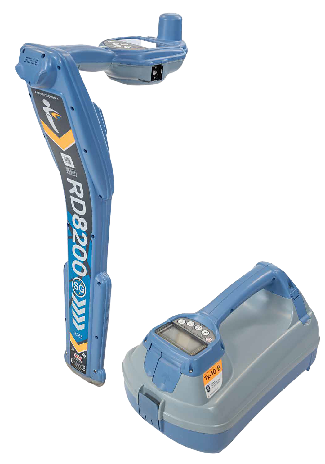
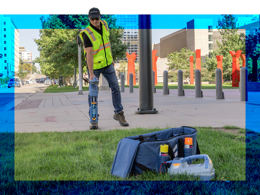
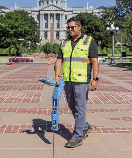
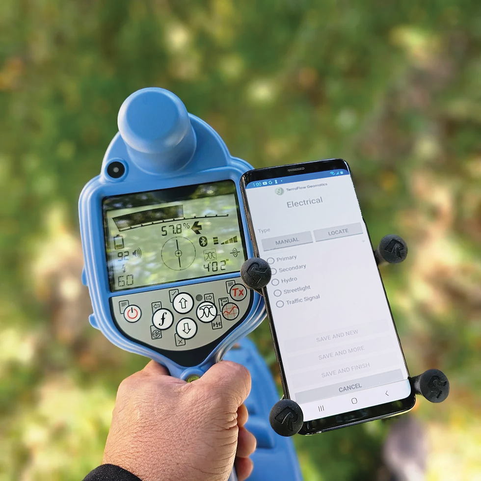
1. Radiodetection RD8200SG
Precision Locating Meets Survey-Grade Mapping
The RD8200SG is our most advanced solution, engineered to integrate high-accuracy mapping directly into your utility locate procedures.
- Survey-grade GNSS integration for precise asset positioning.
- Simultaneous depth and current measurement for confident verification.
- Multi-frequency operation to handle complex utility environments.
- Power Filters™ to reduce interference in congested areas.
- Long-range signal transmission with TX-10B for challenging sites.
What it means for you:
Accurately detect and trace underground utilities—while capturing GIS-ready data in real time.
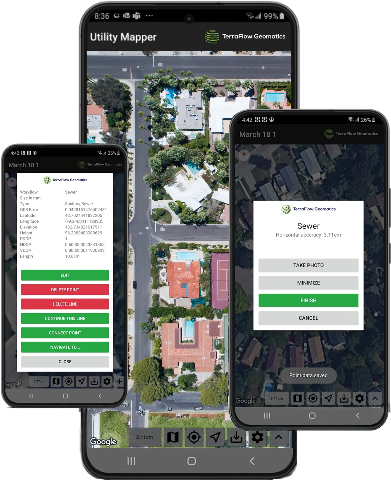
2. TerraFlow Utility Mapper
From Field Capture to Deliverables—Faster and Smarter
Move away from paper sketches and manual entries. TerraFlow transforms how your crews collect and manage utility data.
- Flexible, configurable workflows tailored to your operations.
- Real-time data capture and synchronization.
- Seamless integration with office software, reports, and GIS systems.
- Bluetooth connectivity with industry-standard locators.
- Scalable accuracy options—from sub-meter to centimeter-level.
What it means for you:
Your field data flows directly into your deliverables—cleaner, faster, and without rework.
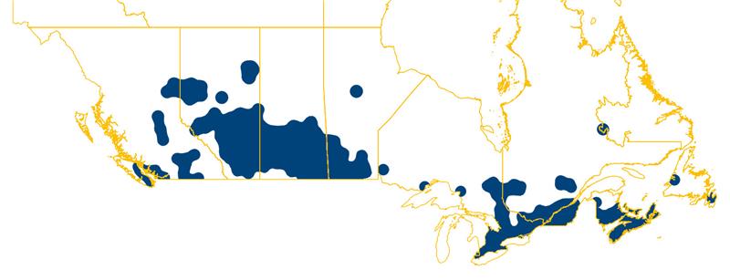
3. Can-Net RTK Corrections
Consistent, High-Accuracy Positioning—Anywhere You Work
Leverage Canada’s largest Virtual Reference Station (VRS) network to achieve consistent, centimeter-level accuracy.
- Centimeter-level accuracy using RTK and VRS technology.
- Extensive nationwide coverage with 300+ reference stations.
- Fast initialization and reliable uptime.
- No base station required—lower cost and simpler deployment.
- Supports multiple crews simultaneously.
What it means for you:
Reliable, high-precision positioning—so every point you capture is accurate, repeatable, and defensible.