The Trimble Connect
Multi-Pane Viewer
High-Performance Analysis via the Trimble Reality Capture Platform
Purpose-Built for Large, Complex Infrastructure Data
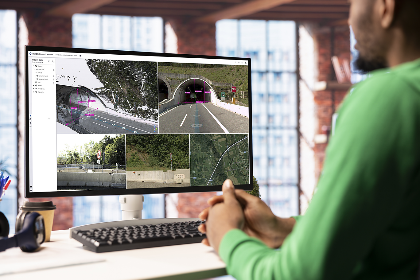
Trimble Connect is designed to handle the unique scale and complexity of large infrastructure datasets, and it’s now enhanced with a powerful new multi-pane viewer. Accessible via the Trimble Reality Capture platform service, this new capability gives you a high-performance environment to view, compare, and analyze your data like never before.
See Everything. All at Once.
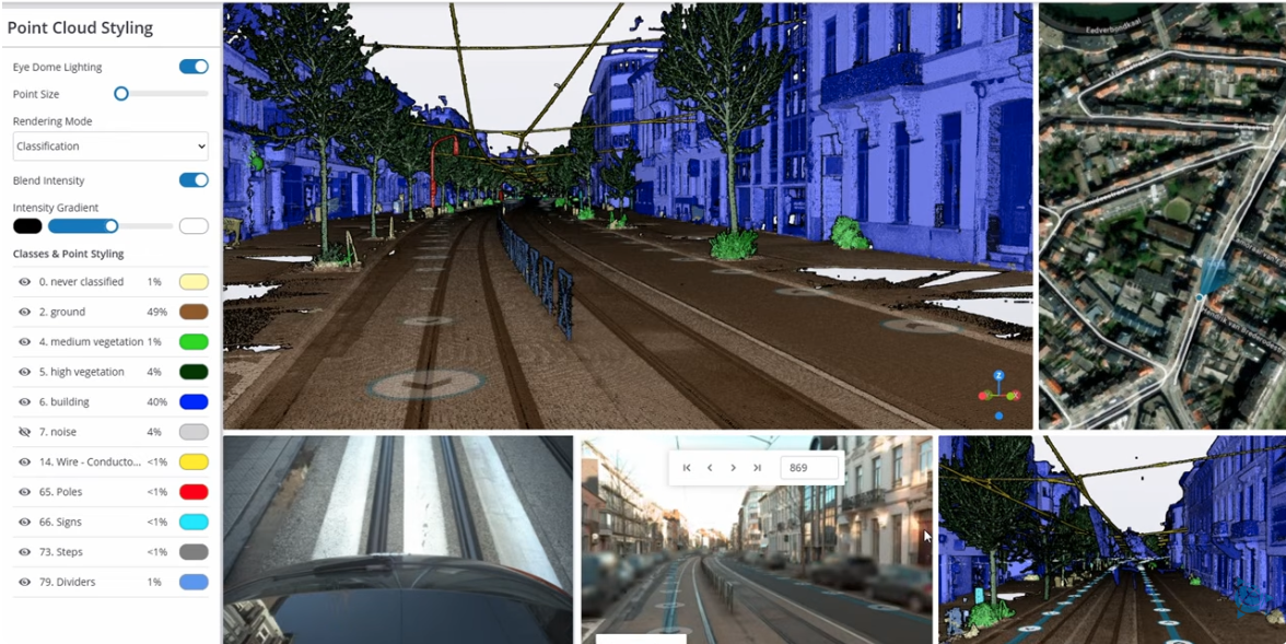
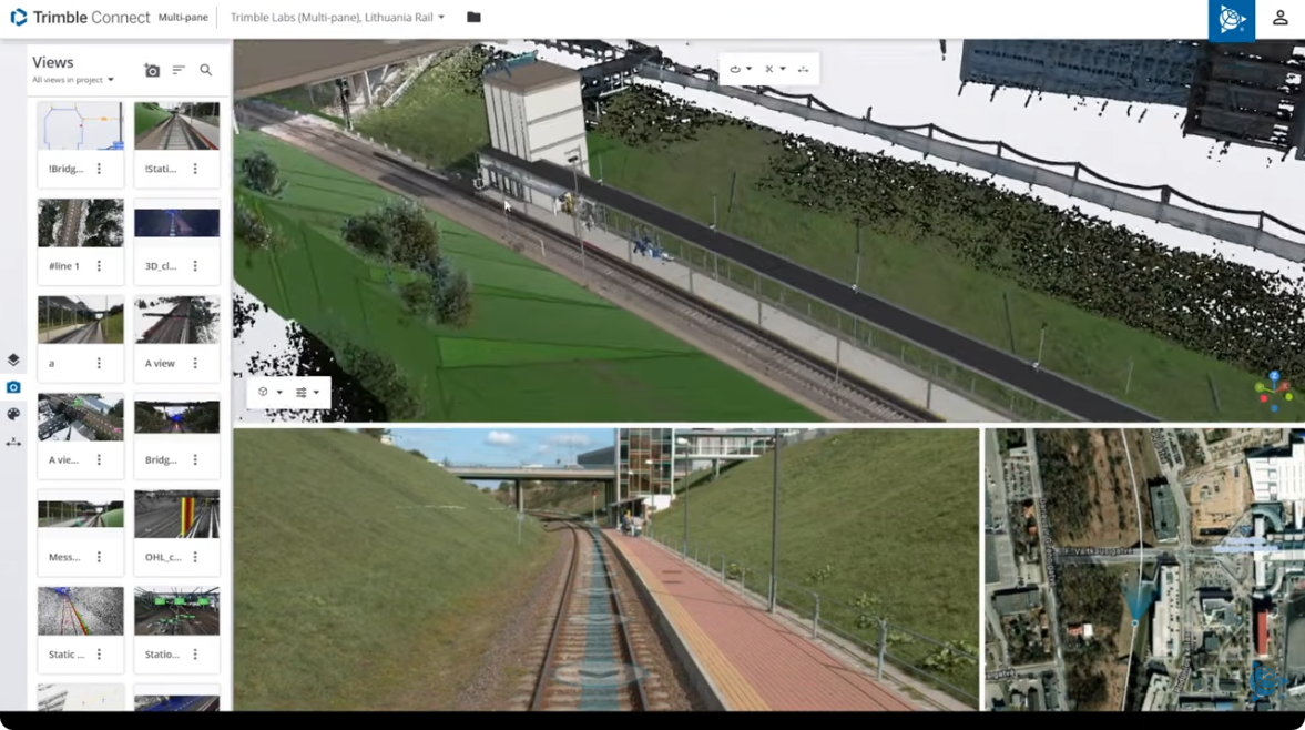
The multi-pane viewer allows you to visualize reality capture data and design models side-by-side in a single, synchronized workspace—so you can analyze your project in full context without switching between tools.
Why It Matters to You
- Work faster with multiple synchronized views (map, 3D, cross-sections).
- Make confident decisions with real-world data aligned to design models.
- Reduce complexity by eliminating disconnected workflows.
- Collaborate seamlessly in a shared cloud environment.
Built for Real-World Infrastructure Workflows
Designed for professionals working with high-complexity datasets who need more than just visualization—this is about deep analysis in context.
-
Transportation & Roads
-
Rail Infrastructure (GEDO Workflows)
-
Utilities & FTTH
Perform detailed road inspections (cracking, potholes) and manage asset inventory including signs, poles, and ADA ramps.
Conduct clearance analysis, assess track quality, and inspect overhead lines using GEDO scan data.
Map above-ground assets and plan fiber rollouts in challenging environments with greater accuracy and efficiency.
Key Capabilities
- Multi-Pane Synchronization
View maps, 3D models, and cross-sections simultaneously—fully aligned for deeper insight. - Trajectory-Based Navigation
Follow the exact path of your mobile mapping capture (vehicle or rail) with smooth, high-performance image loading. - Linear Infrastructure Analysis
Access specialized tools for alignments, including cross-sections and unique rail support for chainage lines and canted measurements. - Connected Ecosystem
Overlay design (IFC) models with reality capture data—bringing design and field conditions together in one platform.
How to Access
- Platform: This feature is accessible through the Trimble Reality Capture platform service.
- Value-Add: The multi-pane viewer is available to Trimble Reality Capture subscribers at no additional cost.
- Data Integration: It is designed for high-performance visualization of data processed in software such as Trimble Business Center (TBC) or GEDO Scan Office.