


DJI Matrice 400 (M400) with Enterprise Care Plus 1 Year Warranty Auto- Activated and RC Plus 2
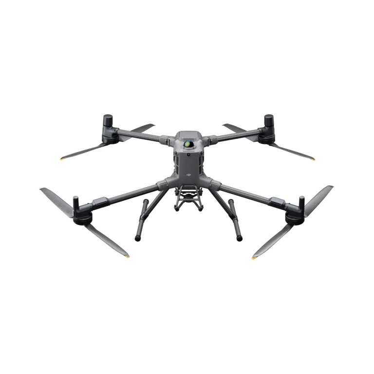
DJI Matrice 400 (M400) with Enterprise Care Plus 1 Year Warranty Auto- Activated and RC Plus 2
Description
DJI Matrice 400 Enterprise Drone with RC Plus 2 Controller
The DJI Matrice 400 Enterprise Drone is a heavy-lift, long-endurance aerial platform designed for complex surveying, inspection, and industrial operations. Built for demanding enterprise workflows, the Matrice 400 supports advanced payloads and extended missions, making it ideal for large-scale mapping, infrastructure inspection, and asset monitoring applications.
Key Features — Matrice 400 Drone
- Heavy-Lift Payload Capability
Designed to support a wide range of enterprise payloads, including high-resolution cameras, LiDAR, and inspection sensors for advanced data capture. - Long-Endurance Performance
Optimized for extended flight times and large-area coverage, enabling efficient surveying and inspection across expansive or remote sites. - Precision & Automation
Supports intelligent flight modes and automated mission planning for repeatable, high-accuracy data collection in complex environments. - Rugged Enterprise Design
Engineered for demanding industrial conditions, delivering reliable performance for critical infrastructure and field operations.
Key Features — RC Plus 2 Enterprise Controller
- Rugged Field Controller
High-brightness display and durable construction designed for professional use in challenging jobsite conditions. - Reliable Control & Telemetry
Provides real-time access to flight data, payload feeds, and telemetry for precise control and situational awareness. - Enterprise-Ready Workflow
Supports advanced mission planning and payload control for complex surveying and inspection operations.
Ideal For
Surveyors, inspection professionals, and enterprise operators requiring a heavy-lift, long-endurance drone platform for large-scale mapping, utilities inspection, mining, energy, transportation infrastructure, and industrial asset monitoring.
Documents
Specifications
- BrandDJI Enterprise
- Product TypeDrone
- Drone TypeMulti-rotor
- Flight Speed25 m/s
- Infrared Thermal Camera Built InN/A
- IP RatingIP55
- Maximum Flight59 minutes - Maximum coverage in one flight: 550 ha (1360 ac) at 2.7 cm GSD
- NIR Auxiliary Light Built InN/A
- Operating Temperature-20°C to 50°C (-4°F to 122° F)
- Payload Capacity6 kg
- RTK CapabilityRTK Onboard
- RTK Positioning Accuracy1 cm + 1 ppm (Horizontal), 1.5 cm + 1 ppm (Vertical)
- Warranty1 year